
Kugluktuk
Kugluktuk is the westernmost community in Nunavut. It is located north of the Arctic Circle on the Canadian mainland at the mouth of the Coppermine River where it feeds into Coronation Gulf, which is part of the Northwest Passage.
It has a unique microclimate that extends a narrow band of stunted boreal forest trees northwards toward the Arctic Ocean. ‘Kugluktuk’ means ‘place of moving water’ and the root word ‘kugluk’ means ‘waterfall.’ Upriver from this hospitable hamlet is the beautiful Kugluk cascade, also known as Bloody Falls, an ancient fishing and hunting location that is now a territorial park of historic cultural importance.
Kugluktuk
ᖁᕐᓗᖅᑐᖅ
'Place of moving water'
1,400
90% Inuit
Inuinnaqtun, English
Longitude 115° 07’ W
Latitude 67° 49’ N
Elevation 23m
Kugluktuk is situated beneath rocky hills at the mouth of its large, swift flowing river that feeds into the Arctic Ocean at the southwestern corner of Coronation Gulf.
Weather & Climate
The average temperature in Kugluktuk is the warmest in Nunavut, sometimes rising to 30°C in the summer. Winter temperatures range from -15°C to -40°C.
| Average Temperature in Kugluktuk | |||
|---|---|---|---|
| January | -28oC | February | -27oC |
| March | -25oC | April | -17oC |
| May | -5oC | June | 5oC |
| July | 11oC | August | 9oC |
| September | 3oC | October | -7oC |
| November | -20oC | December | -26oC |
Kugluktuk enjoys constant 24-hour sunshine from May 27 to July 17.
Current Weather in Kugluktuk
Broken Clouds
-11°
-
Sun
-
Mon
-
Tue
-
Wed
History
The Inuit of Kugluktuk speak Inuinnaqtun — a slightly different language from Inuktitut — because they are Copper Inuit people, descendants of the ancient Thule with distinct cultural traditions.
- Thule Culture (Proto-Inuit): 1000 AD to 1600 AD
- Inuit Culture (Eskimo): 1600 AD to present-day
The Copper Inuit were so named because they made arrowheads, spearheads, ulu blades, chisels, harpoons and knives from copper that was sourced along the shores of the Coppermine River. This valuable survival resource, plus the nice local climate with its great hunting and fishing were the same historical reasons why the Dene First Nations people lived here.
The Dene people were the original inhabitants and violent ethnic feuds with the Thule and Inuit people continued for centuries. A sacred healing ceremony to reconcile these ancient native grievances took place in 1996.
The Hudson Bay Company sent an expedition led by Samuel Hearne to search for copper in this area. Hearne followed the storied river to its mouth and named it the Coppermine in 1771. The local Inuit community went by this same name until it was changed in 1996.
In 1865 an influenza epidemic spread along the Coronation Gulf coast, wiping out 30% of the population. From 1913 to 1916, Diamond Jenness, the famous Canadian ethnologist, studied and recorded the traditional lifestyle of Inuit in the Coppermine area.
The Hudson Bay Company established a trading post here in 1927. In 1932 the Royal Canadian Mounted Police built a police station. Radio facilities, weather station, nursing station and a day school soon followed. Oil and gas exploration companies in the 1970s trained and employed a large portion of the local population. In 1996 a permanent peace was made with the Dene people and the community changed its name to Kugluktuk.
Activities and Wildlife
In the summertime when it is very green here with wildflowers, berry plants and green grasses, canoeists, kayakers, boaters and river rafters love to explore the Coppermine River from Kugluktuk to Bloody Falls and back.
Hiking, camping, hunting, fishing and snowmobile riding are popular outdoor activities. You can also go golfing! The Kugluktuk Golf Club has an 18-hole course located along the picturesque shores of Coronation Gulf.
Herds of caribou migrate nearby and the sea contains abundant ringed seals to hunt. Char and whitefish are plentiful here. Ravens are playful year-round residents. Peregrine falcons, rough-legged hawks and bald eagles frequent the upstream sections of the Coppermine River where you can also find moose, muskoxen, wolverines, foxes and barren land grizzly bears.
In April there is a weeklong festival called ‘Nattiq Frolics’ with traditional Inuit games, dancing, feasting, seal hunting contests and snowmobile races.
Every summer the landscape is dappled with arctic flowers, mosses, lichens, blueberries, blackberries, cranberries, stunted spruce and dwarf birch trees.
Arts and Culture
Kugluktuk is home to many artists; the most notable is Inuk painter John Allukpik.
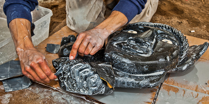
Local carvings are made from a variety of materials, such as white dolomite stone, musk ox horn, walrus tusk ivory, caribou antler and ancient whalebone.
The co-op store sells local arts and crafts. The Kugluktuk Heritage Visitor Centre showcases other fine artworks from this area, including igloo carvings and handmade Inuit dolls.
Parks
Kugluk (Bloody Falls) Territorial Park
This lovely park is located 15 kilometres (9 miles) southwest of Kugluktuk. It features 25 acres of beautiful terrain near the scenic waterfalls of the Coppermine River where it narrows into a cascade of churning rapids and twisting eddies.
Ethnic feuds persisted for centuries. The waterfalls get their English name from a bloody incident witnessed by the British explorer Samuel Hearne in 1771 when a group of Inuit fishermen camped at the falls was ambushed and massacred by Dene warriors. It was designated a National Historic Site in 1978.
Inuit and Dene representatives participated in a sacred healing ceremony in 1996 to reconcile their ancient tribal grievances. The Inuinnaqtun name ‘Kugluk’ means ‘waterfall’ and the campsite area below the falls is called ‘Onoagahiovik’ which means ‘the place where you stay all night’ because the fishing is that good.
Coppermine River
The Coppermine River was nominated as a Canadian Heritage River in 2002 for its outstanding heritage and recreational values. It is currently awaiting official designation by the Canadian Heritage Rivers System Board.
The Coppermine River played an important role in northern exploration and the fur trade. Copper deposits on its shores attracted native peoples to the river. Archaeological sites with ancient copper artifacts are scattered along the course of this waterway. It was because of stories told about copper found here that Samuel Hearne explored this river in 1771.
Other explorers soon followed and the Coppermine became an important northwestern Canadian trading route. The river valley has boreal spruce and birch trees living far north of the tree line. It is home to moose, caribou, muskoxen, falcons, hawks and eagles.
This special place has a shared history between Inuit and Dene First Nations people that has not always been friendly.
Visitor Information
Kugluktuk Heritage Visitor Centre and Museum
Phone: (867) 982-3570
Fax: (867) 982-3573