Welcome to your arctic adventure of a lifetime!
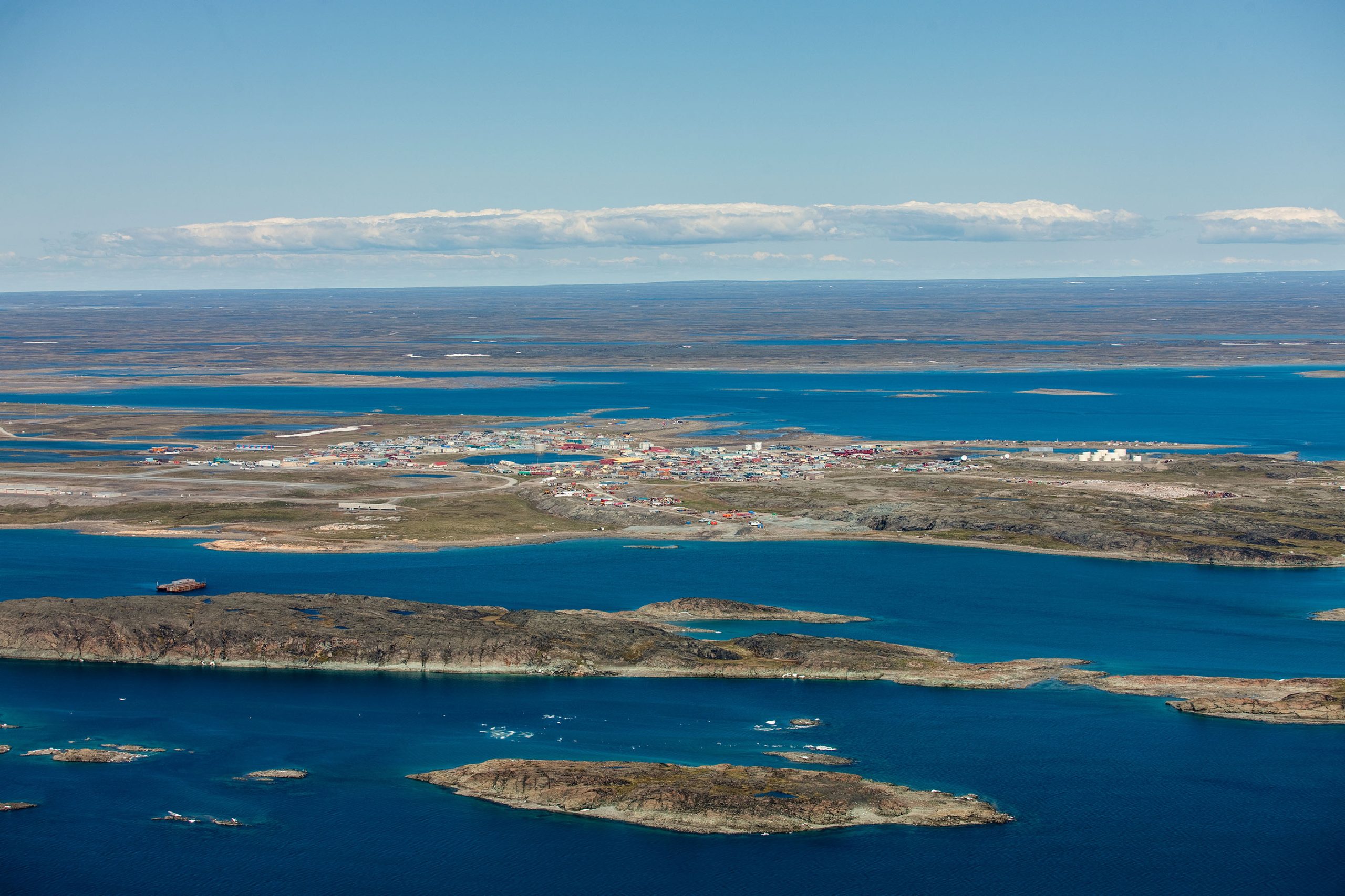
The first impression many visitors have of Nunavut is that of its vast expanses of pristine wilderness. Comprising most of the Canadian Arctic Archipelago, about one fifth of the total landmass of the nation, Nunavut is the size of Western Europe. It is the largest yet least populated of all the provinces and territories in Canada, with a total area of 2,093,190 square kilometres (808,190 square miles) and a population of approximately 33,330 people — 84 percent Inuit. With one person for every 65 square kilometres (25 square miles) of arctic wonderland, the feeling of gigantic natural space is absolutely true!
Nunavut can only be accessed by air and sea. You cannot get here by car and Nunavut communities are not linked together by highway. Travelling between Nunavut communities is usually done by aircraft or cruise ship, but in some cases it is possible to reach another community by snowmobile, dogsled expedition or powerboat.
- Qikiqtaaluk Region: (867) 979-5391
- Kivalliq Region: (867) 645-2810
- Kitikmeot Region: (867) 982-3310
- Toll-free: 1-800-220-6581
History
The vast geographical area that is now fondly known as Nunavut has supported a continuous indigenous population for over 4,000 years.
- Paleo-Eskimo Culture: 2500 BC to 1500 BC
- Pre-Dorset Culture (‘Saqqaq’): 2500 BC to 500 BC
- Dorset Culture (‘Tuniit’ or ‘Sivullirmiut’): 500 BC to 1500 AD
- Thule Culture (Proto-Inuit): 1000 AD to 1600 AD
- Inuit Culture (Eskimo): 1600 AD to present-day
Most historians today identify Baffin Island with the ‘Helluland’ (place of black rocks) described in ancient Norse sagas. It is believed that both the Dorset and Thule inhabitants of the region had regular contact with Norse sailors over a thousand years ago. Archaeological remains of Vikings have been discovered on Baffin Island that include Norse architectural materials, yarn spun from a hare, tally sticks, plus a carved wooden face mask depicting white European features. These ancient remains indicate that Norse traders and possibly settlers on Baffin Island appeared no later than 1000 AD, with intermittent contact lasting until 1450 AD.
After the Norse sagas, the next written historical records of the territory now called Nunavut began in 1576 with an account by the English explorer Martin Frobisher who led an expedition to find the Northwest Passage and recorded his contact with Inuit. He mistook a long bay for what he called ‘Frobisher’s Straites,’ which do not lead to China, and the large quantity of ‘gold’ ore he shipped back to England was pyrite — fool’s gold. Other European explorers in search of the elusive Northwest Passage followed in the 17th century, including Henry Hudson, William Baffin and Robert Bylot. The Hudson Bay Company began fur trading with Inuit in the late 17th century. European and American whaling vessels frequented Nunavut waters throughout the 18th and 19th centuries. Local Inuit were hired as expert whalers. The great Norwegian explorer Roald Amundsen was the first European to finally locate and successfully transit the Northwest Passage in 1906.
During the Cold War in the 1950s, concerned about the Arctic’s strategic geopolitical position, the Government of Canada forcibly relocated a number of Inuit families from northern Québec to Resolute and Grise Fiord. In the unfamiliar and hostile conditions of the High Arctic, they faced starvation and great difficulty adapting. Forty years later, the Government of Canada apologized and paid compensation to those affected and their descendants.
In 1976, as part of the land claims negotiations between the Inuit Tapiriit Kanatami (then called the Inuit Tapirisat of Canada) and the Federal Government of Canada, the parties discussed division of the Northwest Territories to provide a separate territory for the Inuit. On April 14, 1982 a plebiscite on division was held throughout the Northwest Territories. A majority of the residents voted in favour. The land claims agreement was completed in September 1992 and ratified by 85% of voters. On July 9, 1993 the Canadian Parliament passed the Nunavut Land Claims Agreement Act and the Nunavut Act. The new territory of Nunavut was founded on April 1, 1999.