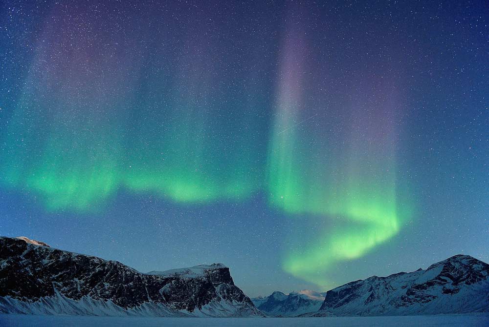
Arctic Bay is a vibrant, traditional community located in the northwest corner of Baffin Island. This safe harbour hamlet is situated upon a south-facing gravel beach on Adams Sound, which feeds into Admiralty Inlet, draining northwards to Lancaster Sound and the Northwest Passage.
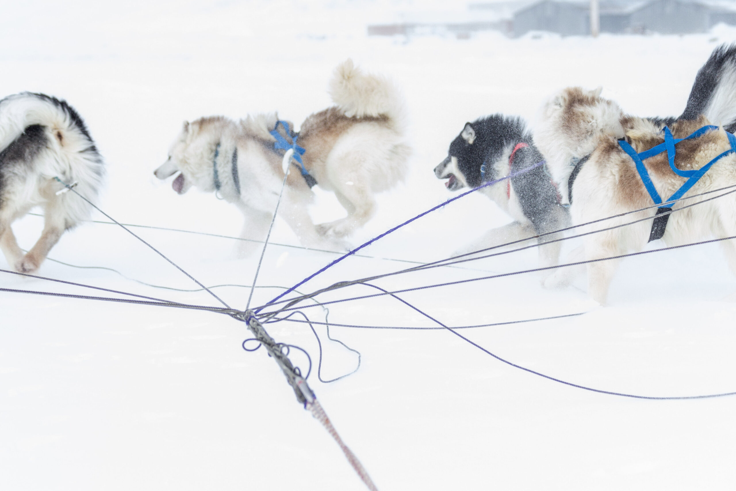
Its sheltered shores and steep cliffs provide nesting habitat for many unique species of High Arctic birds and its sea waters are home to narwhals and bowhead whales. Every year in the spring a popular dog sledding race takes place between Arctic Bay and Igloolik that draws the best teams from across Nunavut.
750
95% Inuit
Inuktitut, English
Longitude 85° 10’ W
Latitude 73° 02’ N
Elevation 31m
The dramatic terrain around Arctic Bay is comprised of scenic geological formations, with hoodoos, flat-topped pillars of stone and sheer 183 metre (600 foot) red rock cliffs. Repeated ice age glacial erosion created deep valleys and beautiful fiords, including nearby Admiralty Inlet, which is the longest fiord in the world.
WEATHER & CLIMATE
Summer temperatures range from 0°C to 15°C. Protected from strong north winds, Arctic Bay enjoys a surprisingly stable climate. Fall and spring weather is variable, with temperatures between 0°C and -30°C. The snow begins to melt in May, but the sea ice doesn’t break up until the end of July. Winter temperatures hover around -35°C yet can sometimes drop to -50°C on very rare occasions.
| Average Temperature in Arctic Bay | |||
|---|---|---|---|
| January | -29oC | February | -30oC |
| March | -28oC | April | -20oC |
| May | -11oC | June | 0oC |
| July | 5oC | August | 2oC |
| September | -6oC | October | -15oC |
| November | -23oC | December | -27oC |
HISTORY
For 5,000 years the nomadic hunter-gatherer ancestors of the Inuit people came to this place especially for a valuable raw material. At nearby Uluksan Point, located at the mouth of Arctic Bay, slate is found that was ideal for making the ‘ulu’ — woman’s knife.
- Paleo-Eskimo Culture: 2500 BC to 1500 BC
- Pre-Dorset Culture (‘Saqqaq’): 2500 BC to 500 BC
- Dorset Culture (‘Tuniit’ or ‘Sivullirmiut’): 500 BC to 1500 AD
- Thule Culture (Proto-Inuit): 1000 AD to 1600 AD
- Inuit Culture (Eskimo): 1600 AD to present-day
In 1872, a whaling ship called the Arctic, captained by William Adams from Scotland, passed through and gave the area its English names, Arctic Bay and Adams Sound. In 1911, Captain Bernier of Canada arrived here in his sailing vessel, also called the Arctic, to establish and proclaim sovereignty over the High Arctic islands of this region. Norway was trying to claim the archipelago for itself. Bernier left behind some historical markers in this area — a wooden cross, several cairns, painted rocks, a lead plaque and a grave.
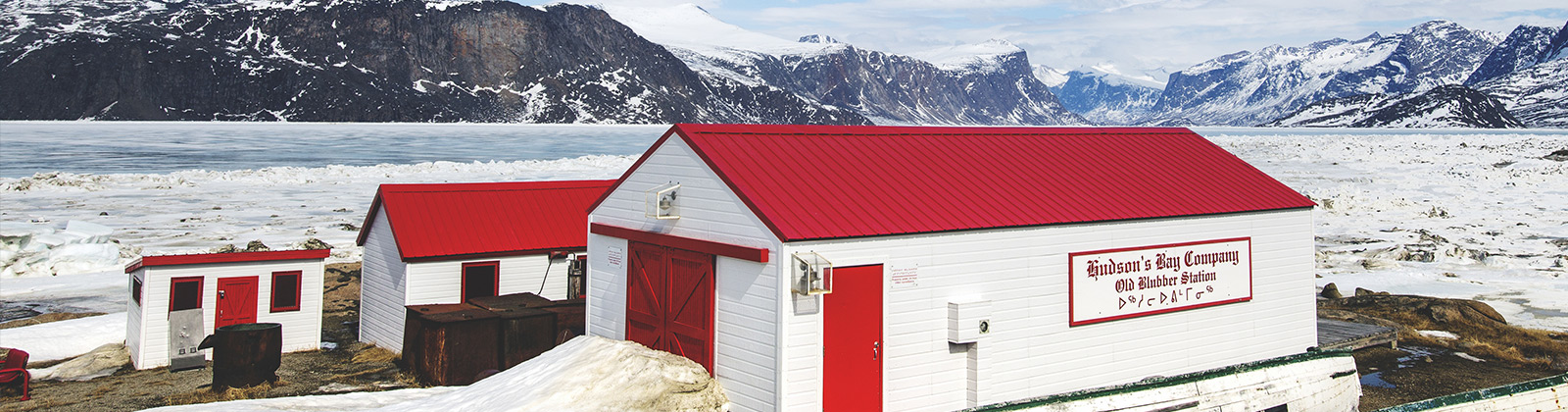
The Hudson Bay Company built a trading post here in 1926, but closed it down the next year. Until it reopened in 1933, local Inuit were forced to travel 240 kilometres (149 miles) to Pond Inlet or 425 kilometres (264 miles) to Igloolik to conduct trade. Reverend Jack Turner opened an Anglican mission in 1937 at nearby Moffat Inlet.
The first school was erected in 1959. Medical facilities and public housing units were constructed in the 1960s. The Government of Canada would not provide social assistance money to nomadic Inuit families living out on the land, so most local people settled into the community during the late 1960s, with the last family moving off the land in 1971. The hamlet of Arctic Bay was founded in 1976.
On October 15, 1976, a lead-zinc-silver mine opened 32 kilometres (20 miles) from Arctic Bay at the small community of Nanisivik. It was the first mine in the world north of the Arctic Circle.
The Nanisivik mine closed down in 2002 and its community was completely dismantled. Expansion of the Arctic Bay airport was begun in 2008. Until the new airport opened in 2011, large aircraft used the Nanisivik airport, which is now mothballed.
ACTIVITIES AND WILDLIFE
Each year when the seaways are open, tourists arrive on High Arctic and Northwest Passage cruise ships to experience the sights and sounds of Arctic Bay, sampling the local cuisine, meeting artists, acquiring carvings and other handicrafts. The sheltered harbour is ideal for yachts in the summer.
Dozens of species of migratory High Arctic seabirds such as thick-billed murres, snow geese, kittiwakes, ivory gulls and Ross’s gulls have breeding grounds in the vicinity that are very active in the summer. Hiking, camping and fishing are popular local activities in nearby Sirmilik National Park. Snowmobiling, cross-country skiing and dog sledding tours are other fun things to do. Traditional Inuit games, competitions, dances and community feasts take place here each spring in conjunction with the annual dog sledding race between the communities of Arctic Bay and Igloolik.
ARTS AND CULTURE
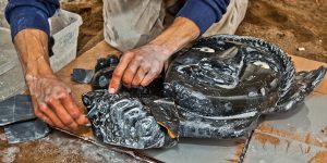
Arctic Bay artists and seamstresses produce high-quality marble carvings, ivory sculptures, traditional clothes and other fine crafts and artworks that can be viewed and purchased directly from the talented local artists themselves. The Qimatuligvik Heritage Organization, which is run by the hamlet and open year-round, is an excellent venue to learn more about the local Inuit culture, with a diorama display plus arts and crafts gift shop.
PARKS
Sirmilik National Park
Arctic Bay is near the western boundary of Sirmilik National Park. This huge park represents the Northern Eastern Arctic Lowlands Natural Region and portions of the Lancaster Sound Marine Region.
Sirmilik comprises three separate land areas: Borden Peninsula is an extensive plateau dissected by broad river valleys. Oliver Sound is a long, narrow fiord with excellent opportunities for boating, hiking and camping.