The city of Iqaluit is located on Baffin Island at the northern end of Frobisher Bay near the mouth of the Sylvia Grinnell River.
This exciting, dynamic city is the political, business, journalism and transportation hub of Nunavut, with an excellent airport. The landing strip is long enough to land the space shuttle, so it is often used for cold weather testing of the world’s largest new aircraft.
Formerly known as Frobisher Bay, the modern city of Iqaluit is rich with traditional Inuit culture. It is the home of many Inuit artists, filmmakers and musicians, plus there are arts and culture festivals staged in the spring and summer that bring artists here from across the territory.
Iqaluit is located near beautiful parklands that feature a range of landscapes, mountains, rivers, waterfalls and ancient Thule sites to visit.
7,250
60% Inuit
Inuktitut, English, French
Longitude 68° 31’ W
Latitude 63° 45’ N
Elevation 34m
City of Iqaluit Map
Iqaluit is situated on gently rolling hills, with rocky outcrops and lush tundra valleys. The tides of Frobisher Bay at Iqaluit rise and fall eight to twelve metres (26-39 feet) twice a day — the second highest tides in Canada after the Bay of Fundy in Nova Scotia.
Weather & Climate
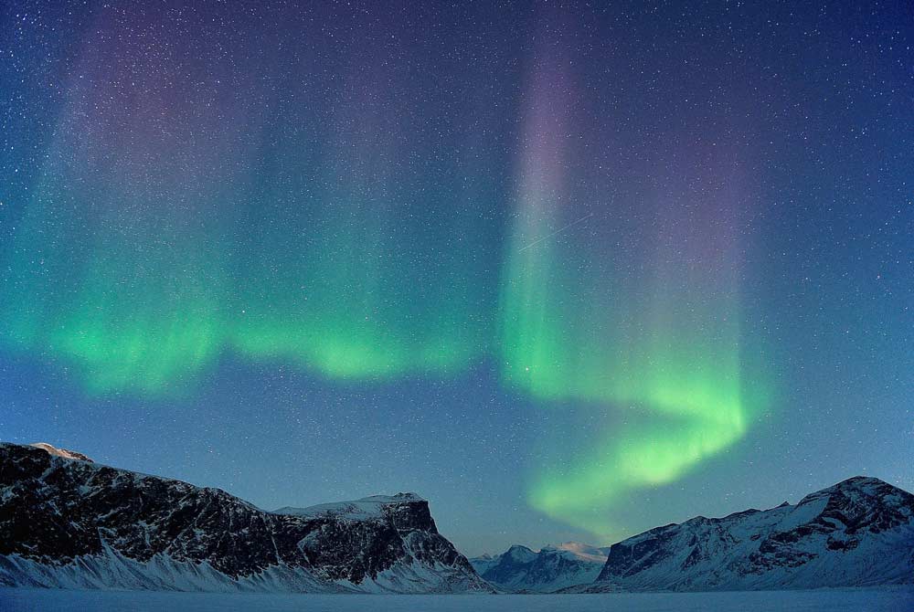
The city enjoys nearly 24 hours of sunshine in late June and early July, with beautiful twilight skies for two hours around midnight. The shortest days of December have four hours of daylight, with the sun hovering on the southern horizon. Northern Lights are frequently seen from October to April. Winter temperatures of -10°C to -32°C are common.
| Average Temperature in Iqaluit | |||
|---|---|---|---|
| January | -27oC | February | -28oC |
| March | -24oC | April | -15oC |
| May | -4oC | June | 4oC |
| July | 8oC | August | 7oC |
| September | 2oC | October | -5oC |
| November | -13oC | December | -23oC |
HISTORY
‘Iqaluit’ means ‘place of many fish’ in Inuktitut. The ancient Thule people knew it well. At nearby Qaummaarviit Island there are several archaeological sites containing thousand-year-old artifacts of these great Inuit ancestors.
He sailed into the bay and believed he had found a direct route to China, so he named it ‘Frobisher’s Straites’ after himself. He thought he discovered gold here too, shipping a large amount of it to England where it was recognized as pyrite — fool’s gold. In 1861, the American explorer Charles Francis Hall arrived in search of the lost Franklin Expedition. He learned from a local hunter named Koojesse that ‘Frobisher’s Straites’ was really just a big long bay and not the fabled Northwest Passage, so he hired Koojesse as his guide and geographer, naming an inlet after him.
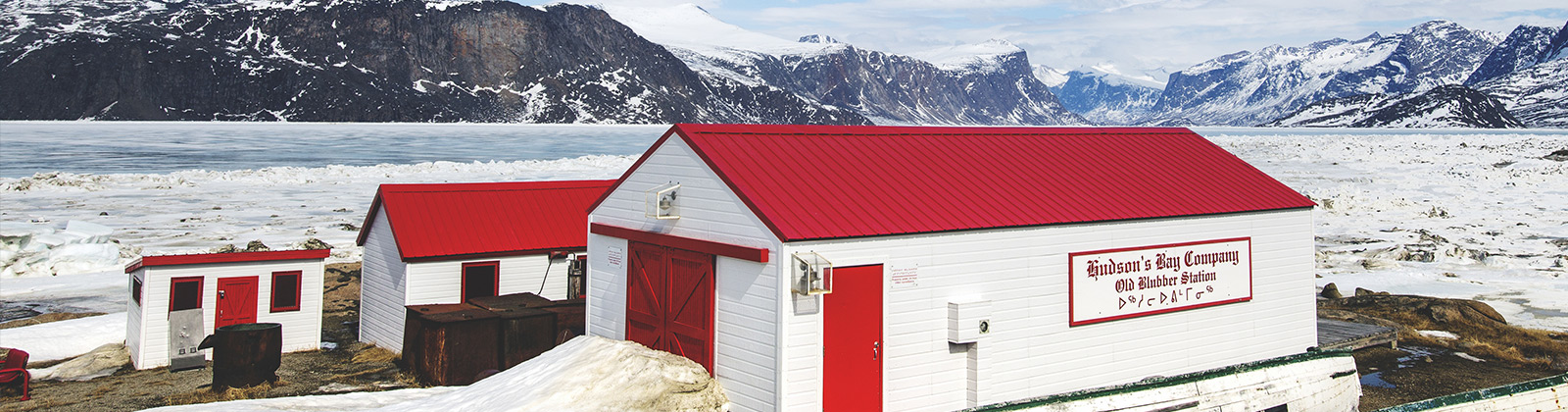
By 1870, Frobisher ‘Bay’ was frequently visited by whaling vessels and fur trading began. Whaling died out in the early 1900s, but the fur trade expanded. Anglican and Catholic missions arrived. In 1914, the Hudson Bay Company (HBC) opened a trading post at Ward Inlet, about 64 kilometres (40 miles) south of here. The Royal Canadian Mounted Police arrived in the 1920s.
Americans chose the location of Koojesse Inlet for a United States Air Force (USAF) base during WWII. The airstrip was operational by 1943. The HBC trading post relocated itself nearby and many Inuit families made permanent homes here. The settlement of Frobisher Bay was born.
During the Cold War 1950s it became part of the NORAD DEW line with a population of 1,200 people (40% Inuit) in 1957. The federal government of Canada brought in doctors, teachers, administrators, clerks and support staff. Large numbers of Inuit people continued to settle here. The USAF pulled out in 1963. In 1987 the community changed its name back to Iqaluit, reverting to the original Inuktitut name. The Nunavut Land Claims Agreement was signed here in 1993. By plebiscite in 1995 Iqaluit was chosen to be the capital of the new territory of Nunavut — which officially came into being on April 1, 1999.
ACTIVITIES AND WILDLIFE
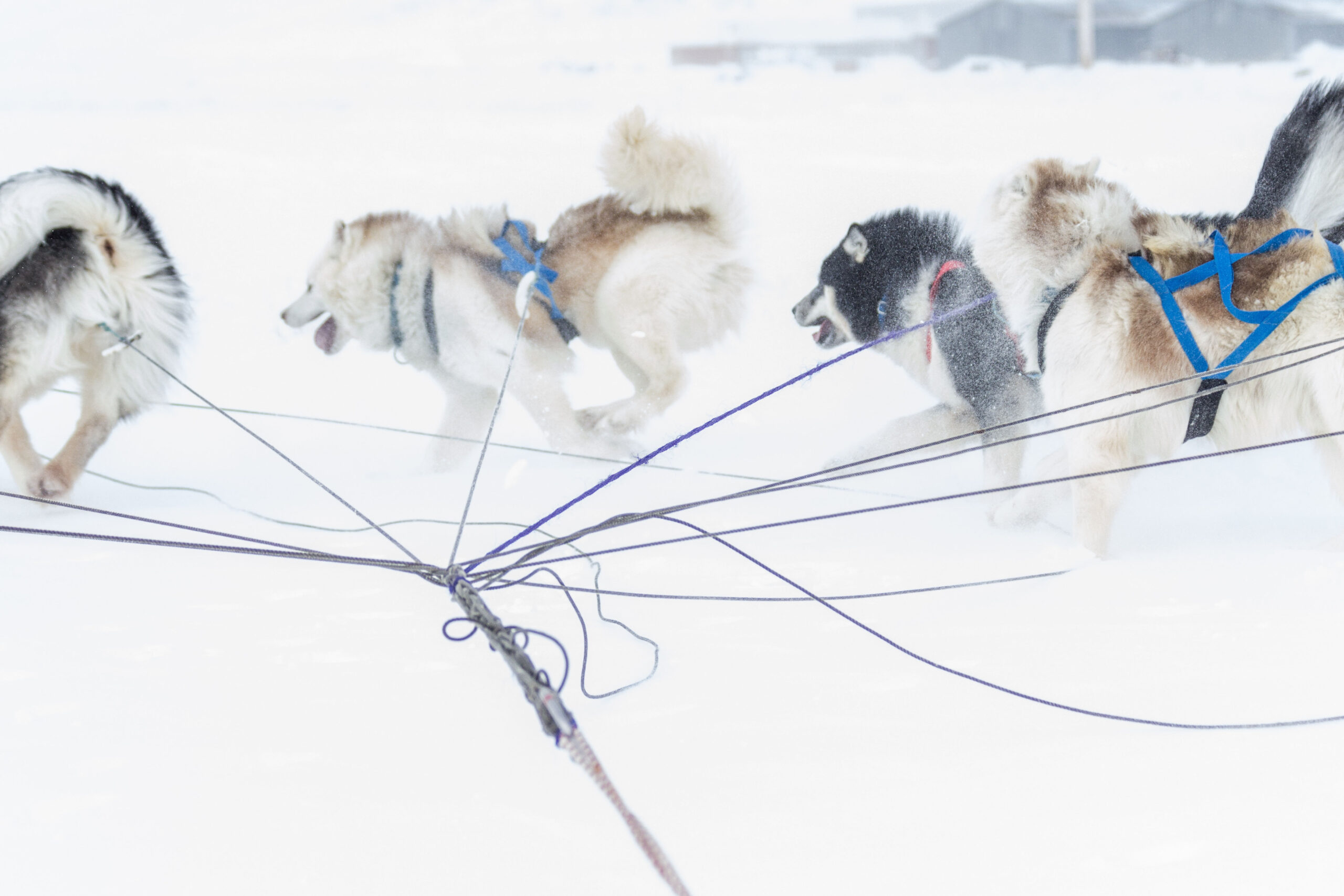
Dog sledding, cross-country skiing and snowmobiling are very popular activities in Iqaluit, also boating, river rafting, canoeing, kayaking, kite skiing and tobogganing.
In the summertime, there are many scenic places to go hiking, fishing, camping and berry picking, such as Sylvia Grinnell Park, the Road to Nowhere and the seaside trail to Apex.
Arctic hares, lemmings and arctic foxes are often found nearby. Caribou are found farther away. When the sea ice breaks up, inquisitive seals can be spotted from town.
There are many opportunities to go hunting and fishing in both summer and winter. Permits are available and local experts will guide you to the best sites. Sledding expeditions into nearby Tarr Inlet, Sylvia Grinnell Park and Katannilik Park are great ways to spend a winter or spring day!
ARTS AND CULTURE
Iqaluit has a superb arts tradition.
Locally made carvings, prints, jewellery and finely sewn items of Inuit clothing can be purchased in several locations.
The Nunavut Arts and Crafts Association (NACA) organize an annual summer festival event showcasing Nunavut artists. The Unikkaarvik Visitor Centre celebrates Nunavut — its lands, people and history. Plus there is an excellent museum.
Nunavut Arts and Crafts Association
Ph: (867) 979-7808
Fax: (867) 979-6880
www.nacaarts.org
Unikkaarvik Visitor Centre
This facility features several cultural exhibits and wildlife displays. It provides maps, tourism and historical information. Unikkaarvik also rents bicycles and shows Inuit movies. With special weekly events, guest speakers and visiting exhibitions, there is always something new and enjoyable happening here.
Ph: (867) 979-4636
Fax: (867) 979-3754
Email: info@destinationnunavut.ca
www.destinationnunavut.ca
Nunatta Sunakkutaangit Museum
Home to a large collection of local and regional Inuit artifacts and fine art, with interpretive displays and travelling exhibits.
Ph: (867) 979-5537
Fax: (867) 979-4533
Traditional cultural activities and the performing arts of Nunavut are showcased in the spring and summer at two very popular festivals.
Toonik Tyme Festival
Iqaluit’s spring festival is held every April. It is a weeklong event that includes traditional Inuit games and activities such as igloo building, dogsled races, snowmobile races, seal skinning contests, musical performances and feasts.
www.tooniktyme.com
Alianait Arts Festival
This is a popular summertime cultural event in Iqaluit, taking place in late June to early July, that features performing and visual artists from Nunavut and around the world for several days of music, theatre, film, circus acts and storytelling.
www.alianait.ca
Parks
Qaummaarviit Territorial Historic Park
Not far from Iqaluit lies the tiny, rocky island of Qaummaarviit, which means ‘the place that shines’ in Inuktitut. This lovely park is rich in archaeological artifacts dating back to the Thule culture that demonstrate the inventiveness and adaptability of this remarkable people. Touring ‘the place that shines’ makes for a great day trip into the ancient past.
Sylvia Grinnell Territorial Park
Situated a short distance from Iqaluit is a picturesque park of rolling hills divided in two by the meandering Sylvia Grinnell River. The river was named Sylvia Grinnell by the American explorer Charles Francis Hall in 1861 for a daughter of his benefactor, the American philanthropist Henry Grinnell, a good friend of Lady Jane Franklin who sponsored Hall to search for the lost 1845 John Franklin expedition. Hall camped here in 1861 and named the inlet that this river feeds into after his Inuit guide Koojesse. The views are breathtaking and local people enjoy camping here all summer long. The park provides washrooms, tent platforms and fire pits. There is a pavillion detailing the history and features of the park. The river is a great place to catch fish and the tundra landscape along its course of rapids and waterfalls is a popular picnic location. There are some ancient Thule ruins near the falls. One of the rarest plants in Canada, the woodsia fern grows here. Caribou and arctic fox live here too.
Katannilik Territorial Park
Countless cascades echo the recurring theme of this natural paradise. The park is an ancient arctic oasis corridor that follows the Itijjagiaq Trail and the Soper Valley — a 120 kilometre (75 mile) traditional overland route from Iqaluit to Kimmirut across the Meta Incognita Peninsula. It has beautiful mountains, cliffs, ravines and valleys to explore plus a great many waterfalls to enjoy. Katannilik contains the biggest trees growing on Baffin Island — Dwarf Arctic Willows that grow to three metres (ten feet) tall. Also unique to this park is one of the world’s best deposits of lapis lazuli, the striking blue gemstone.
The Soper River
The Soper is a Canadian Heritage River located inside Katannilik Territorial Park that flows into the Hudson Strait at Kimmirut. Known locally as Kuujjuaq (‘big river’) the Soper River has many challenging sections of whitewater and numerous waterfalls.
The Soper Valley has a unique microclimate that can be 5°C warmer than the surrounding terrain. It is a wonderful place to view wildlife. You may encounter caribou, ptarmigans, arctic hares, arctic foxes and arctic wolves.
So be alert and prudent, never leave a trail of garbage behind you and always use powerful binoculars or telephoto lenses to view these beautiful yet dangerous animals from a safe healthy distance.